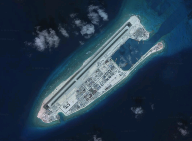
China says Taiwan ‘playing with fire’ over alleged Taiping Island plans Fiery Cross Reef in the South China Sea. (Google Maps/Released)
This article was originally published by Radio Free Asia and is reprinted with permission.
China has reacted strongly against Taiwan’s alleged plans to extend a runway on the contested Taiping Island in the South China Sea, saying it was “playing with fire.”
Taiwanese media reported last week that the island’s military is planning to lengthen the existing 1,150-meter-long airstrip by 350 meters so that it will be able to accommodate F-16 jet fighters and P-3C anti-submarine aircraft.
Taiwanese officials have yet to confirm the plans, reported by United Daily News, a conservative Taiwanese newspaper. But recent satellite imagery suggests some kind of changes on the ground at the western tip of Taiping, which is located in the north-western part of the Spratly islands.
Taiping, also known as Itu Aba, is the biggest natural feature in the Spratly islands. It is currently occupied by Taiwan but is also claimed by China, the Philippines and Vietnam.
On Wednesday, Ma Xiaoguang, spokesman for Beijing’s Taiwan Affairs Office, warned Taipei of “playing with fire” with the Taiping extension plan.
“Any attempt to collude with external forces and betray the interests of the Chinese nation is playing with fire and will surely be punished by both sides of the [Taiwan] Strait,” Ma was quoted by the state-run China News Service (CNS) as saying.
“It will be rejected by the people and punished by history,” he said.
The island, officially considered a “rock” under the United Nations Convention on the Law of the Sea, is named after the warship “Taiping” that China sent to take over the island after Japan surrendered at the end of World War II.
It has been under Taiwan’s control since 1956.
‘Inherent territory’
Ma Xiaoguang was quoted as saying that “the Nansha Islands (Spratly Islands), including Taiping Island, are China’s inherent territory, and China has indisputable sovereignty over the Nansha Islands and its adjacent waters.”
Taiwan’s Ministry of Foreign Affairs on Thursday rejected China’s statement, saying that the islands in the South China Sea belong to the Republic of China (ROC or Taiwan), and “the Taiwanese government’s determination to defend the sovereignty of the islands in the South China Sea has never wavered,” the island’s news agency CNA reported.
The ministry however did not confirm nor deny the alleged runway extension. Taiwan’s air force earlier declined to comment.
Taiwan, Brunei, China, Malaysia, the Philippines and Vietnam, are all claimants of the South China Sea, but China holds the most extensive claim of nearly 90 percent of the sea, demarcated by the so-called nine-dash line.
The U-shaped demarcation line was actually first introduced in 1947 by the ROC and it is now being used by both Taiwan and the People’s Republic of China (PRC or China) to back their claims in the South China Sea.
An international tribunal in the case brought against China by the Philippines in 2016 rejected the Chinese “historical claims” in the South China Sea and invalidated the U-shaped line.
Both Taiwan and the PRC refused to accept the ruling. Taiwan was not party to the case but its claims in the South China Sea are similar to those of China.
Taiping is located in the north-western part of the Spratly islands, 1,500 kilometers (930 miles) from Taiwan and 850 kilometers (530 miles) from the Philippines. It is under the administration of Kaohsiung Municipality.
The current runway was only built in 2008. Proposed plans to develop the infrastructure on Taiping Island were criticized by the other two claimants – the Philippines and Vietnam – as stoking tensions in the disputed South China Sea.
Last week, a Beijing-based Chinese think-tank said it had obtained new evidence of the runway extension plan.
The South China Sea Probing Initiative (SCSPI) said satellite imagery obtained via the satellite data provider Sentinel Hub shows that reclamation work has begun on the western tip of Taiping Island, supporting the news about the island’s intention of extending the existing airstrip to 1,500 meters.
Satellite photos from Sentinel taken on March 24 and April 23 and seen by RFA show noticeable differences in the topography of the western areas of the island.
The Taiwanese Ministry of Defense declined to comment when asked by RFA.
In March, the Taiwanese Defense Minister Chiu Kuo-Cheng said that Taiwan had no intention of militarizing Taiping despite reports that China had completed building military facilities on three artificial islands nearby.


